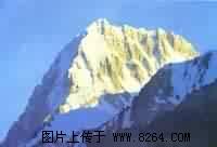
Coronet Peak, 7295 meters above sea level, is located at 76.2 degrees east longitude and 36.1 degrees north latitude. It is located in the middle part of the Karakoram Mountains, on the northwest side of the Chogori Peak, and on the branching mountain range on the side of the Susuegeti glacier. From a distance, it looks like The crown on the king’s head was named after it; although the elevation of the Coronet Peak is less than 8,000 meters, it is famous for its steep steep cliffs on the top and steep ice avalanches.
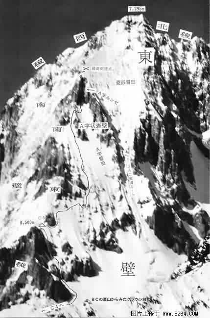
Climbing diagram
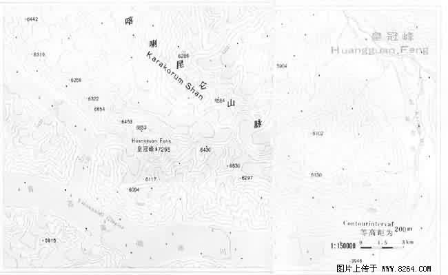
Topographic contour map
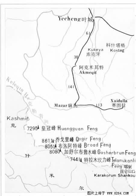
Into the mountain road map
From Yinhong Beach, it is 20 km west of Yinsu Getty Glacier, to Camp Cl in the south of the Coronet Peak, where the altitude is 44lO meters, and the mountaineering base is at 3948 meters above sea level at the tip of the glacier.
Climbing history As early as the end of the l9th century, foreign explorers had conducted several surveys along the Susuegeti glacier, with little success. In the century when mountaineering activities developed to a higher level, the Japanese national team sent four mountaineering teams one after another. In the year of l985, 1987, 1990, and 1992, the four climbed this peak. Although the preparation was relatively complete, it eventually ended in failure. On July 22, 1993, the Japanese team successfully climbed to the top.